Water Resources
Beck’s Lake Road Over Unnamed Branch
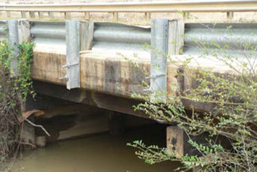
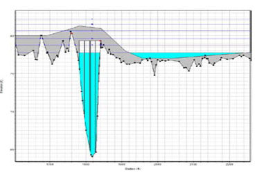
The Beck’s Lake Road Bridge Over Unnamed Branch (Bridge No. 484036) is located in Escambia County, Florida east of the Town of Cantonment approximately 750 feet upstream (south) of Big Rock Creek. The 31.2-foot long, two-span timber bridge was constructed in 1968. The purpose of this project is to replace this structurally deficient bridge. The scope of services for this project included the design and preparation of a complete set of roadway and structure construction plans for a proposed replacement bridge. Drainage design for this project included bridge hydraulics analysis of several bridge replacement alternatives, scour calculations, and bridge deck and roadway conveyance design.
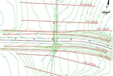
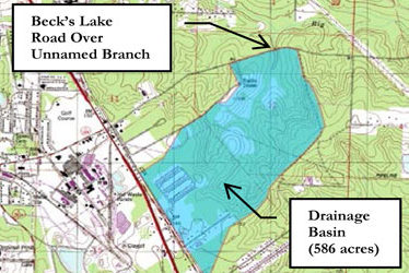
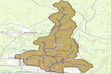
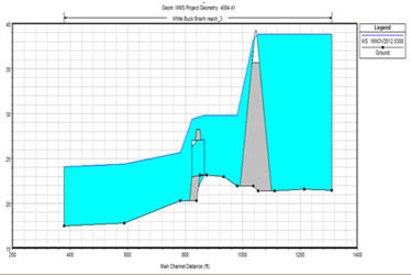
The watershed upstream of the bridge is approximately 586 acres. The Rational Method was used to calculate peak runoff values. Bridge Hydraulics Calculations were performed with the HEC-RAS computer program. Microstation and GeoPak were used to develop the stream center-line and cut cross sections for the HEC-RAS model.
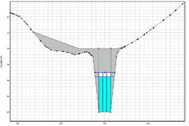
Based on analyzing several structural configurations, a triple 8-foot x 5-foot bridge box culvert was determined to be the most cost effective bridge replacement alternative.
Project: Beck’s Lake Road Over Unnamed Branch
Location: Beck’s Lake Road Cantonment, Florida
Client: Florida Department of Transportation – District 3
Service(s): Bridge Hydraulics – Scour Analysis / Calculations – Roadway Drainage – Stormwater Permitting
Project Engineer(s): Eric Falkenberry, P.E. Sr. Drainage Engineer
Lakewood Manor Dam Break Analysis
In December 2012, CSI completed a Dam Break Analysis for an earthen dam located in the community of Lakewood Manor in Bay County, Florida. The dam was classified as High Hazard due to the roadway (John Pitts Road) located downstream. This dam had a history of failures with one causing over-topping and a closure of John Pitts Road. The Florida Department of Environmental Protection (FDEP) and Northwest Florida Water Management District (NWFWMD) were called in an advisory and regulatory capacity to assist the dam owner. CSI was contracted by FDEP to perform a dam break analysis and prepare flood inundation maps.
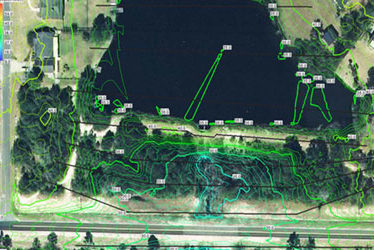
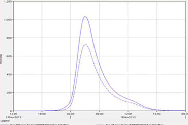
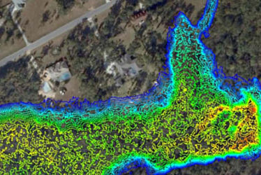
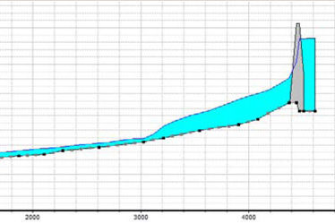
CSI used a combination of the U.S. Army Corps of Engineers HEC-HMS and HEC-RAS programs and the Watershed Modeling System (WMS) program to analyze the upstream basin, develop runoff hydrographs, evaluate the potential for over topping, perform a dam breach analysis, and produce flood inundation maps. WMS was used to process Lidar data, high resolution aerials, and other map data. HEC-HMS and HEC-RAS were used with WMS to develop the flood hydrographs, model the dam failure, and route the flood wave through the downstream channel.
The conclusion and findings of the analysis were that a probable maximum precipitation storm event would likely result in an over-topping of the dam. Such an event could cause a dam failure and adverse flooding downstream.
Project: Lakewood Manor Dam Break Analysis Bay County, Florida
Location: Lakewood Manor Subdivision Bay County, FL
Client: Florida Department of Environmental Protection Bureau of Mining and Minerals Regulation
Service(s): Dam Breach Analysis – Hydraulic Modeling / Routing – Flood Inundation Mapping
Project Engineer(s): Eric Falkenberry, P.E., CFM Sr. Drainage Engineer – Roger Miles GIS/Mapping Specialist
Dam Breach Analyses, Flood Maps, and EAP Michaels and Banner Dams Orange County, Florida
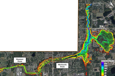
In January – March 2014, CSI was contracted by the FDEP’s Dam Safety Office to complete a cascading Dam Breach Analysis, generate flood inundation maps, and prepare an Emergency Action Plan (EAP) for the Banner and Michaels Dams in Orange County, Florida.
The Banner Dam is located on the E-4 Canal north of SR 50 and West of SR 417. The Michaels Dam is located on the Little Econlockhatchee River approximately 2.7 miles downstream of the Banner Dam. Flood inundation mapping for the project extended approximately 2 miles north of the Michaels Dam to the Orange County/Seminole County line. In addition to two dam structures, the project also included 5 bridges and 2 culverts. The total length of the study was approximately 4.7 miles.
Background information included bathymetric data from a previous countywide flood study by Singhofen & Associates, Inc., LiDAR data by Orange County Engineering, and bridge data obtained from the Federal Highway Administration’s National Bridge Inventory Database. The U.S. Army Corps of Engineers HEC-RAS program was selected because of its abilities to model complex riverine conditions, bridge and culvert structures, and dam failures. The Watershed Modeling System (WMS) and ESRI ArcMap programs were used to prepare flood inundation maps. The map to the right and below shows the flood extents and depths resulting from a
100-year storm and a cascading failure of the dam structures.
Project: Dam Breach Analyses, Flood Maps, and EAP Michaels and Banner Dams Orange County, Florida
Location: Canal E-4 & Little Econlockhatchee River Orange County, FL
Client: Florida Department of Environmental Protection Bureau of Mining and Minerals Regulation
Service(s): Dam Breach Analysis – Hydraulic Modeling / Routing – Flood Inundation Mapping – Emergency Action Plan
Project Engineer(s): Eric Falkenberry, P.E., CFM Sr. Drainage Engineer – Roger Miles GIS/Mapping Specialist
Pine Avenue Pedestrian Bridges Bridge Hydraulics & Scour
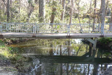
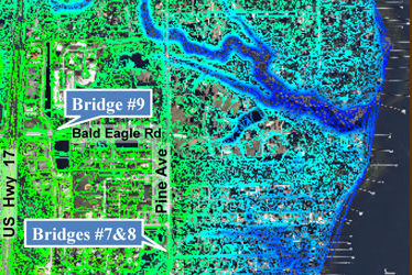
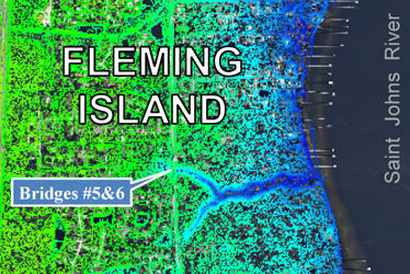
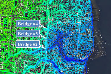
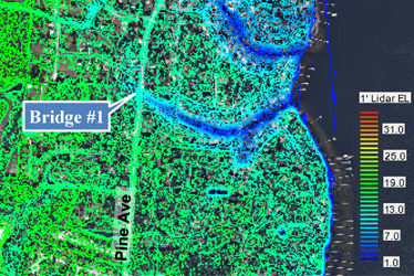
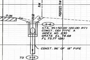
This currently ongoing project involves replacing a total of 9 structurally deficient pedestrian bridges (8 along Pine Avenue and 1 on Bald Eagle Road) on Fleming Island in Clay County, FL. CSI’s scope is for a full redesign effort which includes survey, geotechnical, permitting, roadway, structures, and drainage design services. CSI is performing the roadway, structures, drainage design, and plan production efforts in-house. Subcontracted services include survey by DRMP, geotechnical by CSI Geo, and wetlands delineation by ERS. The drainage design services performed by CSI include basin delineation and hydrologic analyses, bridge hydraulics, scour analyses, and preparation of a summary Bridge Hydraulics Report (BHR).
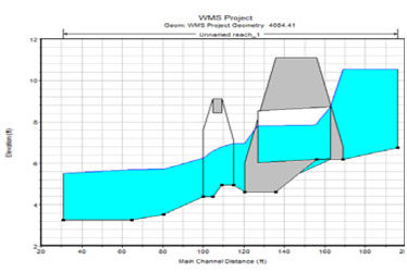
Lidar elevation data and GIS software were used to assist in delineation of basins, calculate basin hydrologic properties, and supplement survey data for constructing the bridge hydraulic models. Bridge Hydraulic and Scour calculations were performed with the U.S. Army Corps of Engineers’ HEC-RAS computer program.
The drainage design also included redesigning and lining some ditches along the project as well as analysis and stabilization of areas experiencing excessive erosion.
Project: Pine Avenue Pedestrian Bridges Bridge Hydraulics & Scour
Location: Pine Avenue and Bald Eagle Road Fleming Island Clay County, Florida
Client: Florida Department of Transportation – District 2
Service(s): Basin Analyses – Hydrology – Bridge Hydraulics – Scour Analyses – Roadway Drainage – Stormwater Permitting
Project Engineer(s): Eric Falkenberry, P.E., CFM Sr. Drainage Engineer
Pineville Road Bridge over Brushy Creek
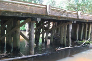
The Pineville Road Bridge over Brushy Creek (Bridge No. 484007) is located in northwestern Escambia County, Florida. The existing 60.6 foot long, four-span timber bridge was constructed in 1967. The purpose of this project is to replace this structurally deficient bridge. The scope of services for this project included the design and preparation of a complete set of roadway and structure construction plans for a proposed replacement bridge. Drainage design for this project included bridge hydraulics analysis of several bridge replacement alternatives, scour calculations, and bridge deck and roadway conveyance design.
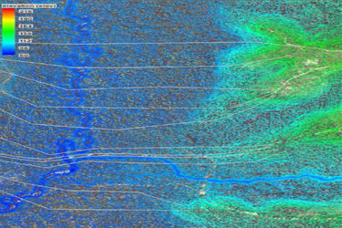
The watershed upstream of the bridge extends north of Atmore, Alabama and was determined to be 48,889 acres (76.39 square miles). The 2011 USGS Regression Equations for Region 1 (Panhandle) were used to calculate peak runoff values. Bridge Hydraulics Calculations were performed with the HEC-RAS computer program. Due to the width of the floodplain, a combination of Lidar elevation data and site survey were used to develop stream cross sections. The Watershed Modeling System (WMS) program was used to process the Lidar data, site survey, and high resolution aerial photographs and develop the necessary geometry and hydraulic properties for the HEC-RAS model.
Project: Pineville Road Bridge over Brushy Creek
Location: Pineville Road Escambia County, FL
Client: Florida Department of Transportation – District 3
Service(s): Bridge Hydraulics – Scour Analysis/Calculations – Roadway and Bridge Deck Drainage – Stormwater Permitting
Project Engineer(s): Eric Falkenberry, P.E., CFM Sr. Drainage Engineer
Woodbine Springs Dam Breach Analysis
In October 2011, an earthen dam located in the Woodbine Springs subdivision began showing signs of seepage and development of a sinkhole in the side of the dam. Actions were immediately taken to prevent a failure, and the Florida Department of Environmental Protection (FDEP) and Northwest Florida Water Management District (NWFWMD) were called to assist the dam owner. CSI was contracted by the FDEP to perform a dam break analysis, produce flood inundation maps, and an Emergency Action Plan (EAP).
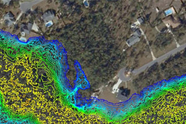
CSI used a combination of the U.S. Army Corps of Engineers HECRAS, the Watershed Modeling System (WMS), and ESRI ArcMap computer programs to analyze the dam and produce the maps. WMS was used to process Lidar data, high resolution aerials, and other map data. HEC-RAS was used with WMS to model the dam failure, develop the flood hydrograph, and route the event through the downstream channel. ArcMap was used for final production of the project location, drainage basin, and flood inundation maps.
The final product was a set of high resolution inundation maps and an Emergency Action Plan for downstream properties that could be at risk from a dam failure.
Project: Woodbine Springs Dam Breach Analysis, Flood Inundation, and EAP
Location: Woodbine Springs Subdivision Santa Rosa County, FL
Client: Florida Department of Environmental Protection Bureau of Mining and Minerals Regulation
Service(s): Dam Breach Analysis – Hydraulic Modeling/Routing – Flood Inundation Mapping – Emergency Action Plan
Project Engineer(s): Eric Falkenberry, P.E., CFM Sr. Drainage Engineer – Roger Miles GIS/Mapping Specialist
