Transportation
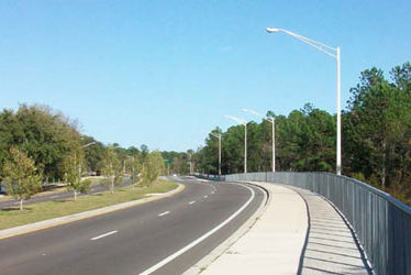
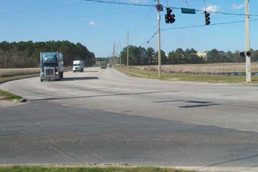
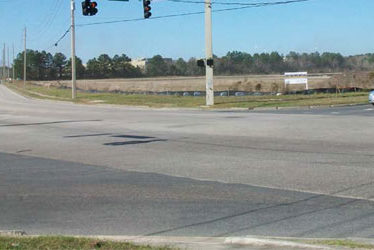
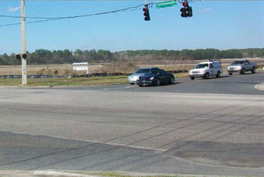
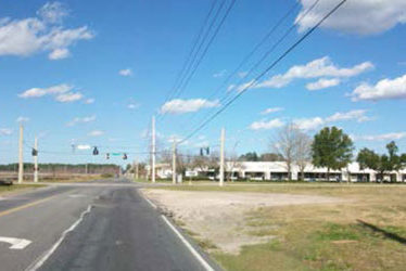
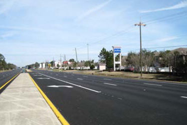
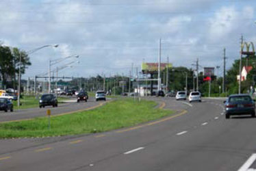
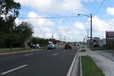
Argyle Forest Boulevard Widening
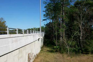
Existing two-lane bridge was replaced with twin bridges each carrying two lanes of traffic and a shared path over McGirts Creek. Included accommodations for decorative lighting and associated pedestal; continuous flat slab design with raised sidewalk/shared path; bridge overtopping for 100-year storm event. Design specified 6-span replacement bridge along with decorative lighting pedestals and enclosures. The superstructure consists of a continuous flat slab resting on concrete pile supported bents. Pile caps required a unique geometry to accommodate light pedestals. Design included the layout of 1,097 LF of MSE wall along with a box culvert extension and an overflow weir.
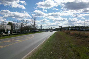
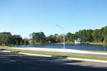
SEGMENT I: CSI provided conceptual to final design services for Argyle Forest Blvd. from Blanding Blvd. to Westport Road, which took it from a 2-lane roadway to a 4-lane roadway for a distance of 2.6 miles. Design services included roadway and bridge design (AASHTO Type II) over McGirts Creek, bridge hydraulics report, gravity wall and MSE wall design, concrete box culvert design and extension, floodplain compensation facility (FPC) design, permitting through SJRWMD and USACE, public involvement meetings with home owners, eight JTA bus pullouts, signing and pavement marking, traffic analysis and study, signalization, lighting, landscape
plan, geotechnical, water and sewer and underground electrical design through JEA, environmental studies and cost estimate.
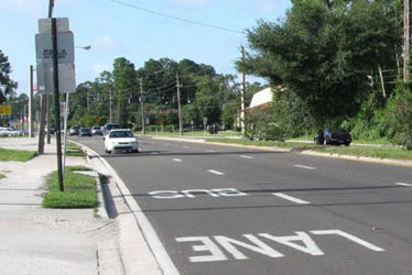
SEGMENT II: CSI provided conceptual to final design services for Argyle Forest Blvd. from Westport Road to Bridge Creek Drive, which took it from a 2-lane roadway to a 4-lane roadway for a distance of 2.0 miles. Design services included roadway widening, drainage design, concrete box culvert design and extension, gravity wall and MSE wall design, permitting through SJRWMD and USACE, public involvement meetings with homeowners, eight JTA bus pull-outs, signing and pavement marking, traffic analysis and study, signalization, lighting, landscape plan, geotechnical services, water and sewer and underground electrical design through JEA,
environmental studies and prepare construction cost estimate.
Project: Argyle Forest Boulevard Widening
Location: Duval County, Florida
Client: Jacksonville Transportation Authority
Service(s): Roadway Design – Bridge Design – Permitting – Cost Estimates – Public Awareness – Wall Design – PD&E Study
Project Engineer(s): Ali Najafi, PE – Christopher Morse, PE
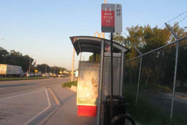
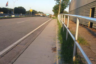
Arlington Expressway at Bethelite Bus Pull-Out and Sidewalk Design
Civil Services, Inc. (CSI) provided design services with JTA/FDOT under a LAP (Local Agency Program) for this new bus pull out on Arlington Expressway Northside Service Road in front of Bethelite. Additional design services included connecting existing sidewalk just past Bethelite to existing sidewalk at the University Blvd. (SR 109).
Other design activities included roadway widening, drainage design, gravity wall and structural wall design, signing & pavement marking. Geotechnical design, landscape plans, surveying, utility relocation, construction cost estimating, utility coordination and project coordination with JTA and FDOT, and specification.
Project: Arlington Expressway at Bethelite Bus Pull-Out and Sidewalk Design
Location: Jacksonville, Florida
Client: Jacksonville Transportation Authority
Service(s): Roadway Widening – Drainage Design – Gravity Wall – Structural Wall Design – Traffic Control Plans – Lighting Design, Signing & Pavement Marking – Geotechnical Design, Landscape Plans – Surveying, Utility Relocation, Construction Cost – Estimating – Specifications
Project Engineer(s): Ali Najafi, PE – Khaled Ramadan, PE – Christopher Morse, PE – Fares Tannous, PE – Scott Grimes
SR 15 / US 17 (CR 220 to Creighton Road) Mill & Resurfacing
Primary goal was to bring this principal rural arterial roadway to the current FDOT’s resurfacing, restoration and rehabilitation (RRR) and safety standards.
The most obvious conditions of this project were the deterioration of pavement asphalt in addition to erosion of the front roadway slope. Drainage pipes and structures had also become inefficient.
Because this is a high residential area, there were daytime limitations on various construction elements. This required intimate communication and coordination with homeowners.
Services included widening inside shoulders, milling and resurfacing existing pavement, pavement design with Superpave Asphaltic Concrete, adjustment of existing MHs in pavement, replacing nonfunctional side drains, construction of curb cut ramps per ADA standards, signing and pavement markings, traffic control plans, construction cost estimates, coordination with utility companies, replacement of signs and signal loops, and project specifications.
Project: SR 15 / US 17 (CR 220 to Creighton Road) Mill & Resurfacing
Location: Clay County, Florida
Client: Florida Department of Transportation
Service(s): Roadway Design
Project Engineer(s): Ali Najafi, PE
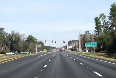
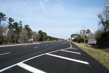
SR 21(Collins Road to 103rd Street) Mill & Resurfacing
Primary goal was to bring this principal rural arterial roadway to the current FDOT’s resurfacing, restoration and rehabilitation (RRR) and safety standards.
This project featured deterioration of pavement asphalt and markings. There were also drainage issues in terms of efficiency of pipes and structures, as well as roadside ditches being compromised by overgrown vegetation.
The main objective in the urban segment of this project was to transform the existing 8.5’ no-parking lanes into 10.5’ lanes to be utilized exclusively by the Jacksonville Transportation Authority. This would require effectively reducing vehicle lane widths from 12’ to 11’ in order to increase the existing no-parking lanes from 8.5’ to 10.5’ for a pilot bus lane project.
Pavement design with Superpave Asphaltic Concrete, milling & resurfacing, replacing non-functional side drains, installing end treatments to some cross drains, constructing paved shoulders in rural section of project, constructing sidewalks in urban section of project, replacement of signal loops, signing & pavement markings, traffic control plans, construction cost estimate, specification, utility relocation, and coordination with utility companies.
Project: SR 21(Collins Road to 103rd Street) Mill & Resurfacing
Location: Jacksonville, Florida
Client: Florida Department of Transportation
Service(s): Milling & Resurfacing – Drainage – Signing & Pavement Marking – Signal Loops Replacement – Specifications
Project Engineer(s): Ali Najafi, PE
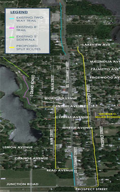
Crescent City Multi-Use Trail
The purpose of this project is to prepare a design and secure approval for implementation of a multi-use trail in the City of Crescent City. The limits of the project begin at the intersection of Grand Rondo E and Central Avenue (where the existing 8 foot trail ends) then east to the intersection with Central Avenue, South on South Main Street to Read Avenue, East to US 17, and south along the existing trail to the intersection of Junction Road’s existing crossing of US 17. From this intersection the project continues along South Prospect Street to Lake View or Magnolia Avenue, then west on Lake View or Magnolia to a proposed new mid-block crossing of US 17 with special emphasis signing and pavement markings to connect to the existing trail that runs along the west side of US 17. The existing sidewalk is to be used as much as possible throughout the project limits.
The project also consists of safety improvements along the project corridor and rehabilitation of the existing sidewalk including adding ADA ramps where needed and repairing damaged sidewalk to meet current FDOT Design Criteria and the Manual on Uniform Traffic Control Devices (MUTCD) and the Manual of Minimum Standards for Design, Construction and Maintenance of Street and Highways (Florida Greenbook). The design activities include a shared use path, appropriate signing and pavement marking plans, and maintenance of traffic plans. Additional activities will include surveying and public involvement.
The proposed trail route had gathered opposition from many residences that would be affected during its construction. To address some of these issues, CSI proposed repair of the existing sidewalk and use of the approved MUTCD/FDOT practice for signs and pavement markings for bicyclists to use the existing roadway, Shared Lane Marking. These markings, commonly called share-rows would indicate that bicyclists may use the full lane and will minimize impact on heritage trees and residential streets.
Project: Crescent City Multi-Use Trail
Location: Crescent City, Florida
Client: Putnam County
Service(s): Multi-Use Trail Design – Sidewalk Rehabilitation – Public Involvement
Project Engineer(s): Ali Najafi, PE
Pickettville Road at Commonwealth Avenue Roadway Reconstruction
This project consisted of widening Pickettville Road with improvements to the Commonwealth Ave. intersection.
Right of way was an issue in this project. City did not want to purchase the land for new right of way. We designed the proposed work inside the existing right of way.
Drainage design involved the rerouting of existing roadside ditches and modifications to a piped system. CSI provided construction plans, estimated construction costs at 60% & 100% stages. Coordinated with St Johns River Water Management District CSI also performed geotechnical investigations, prepared signing and pavement making plans, and coordinated construction with affected utilities.
Project: Pickettville Road at Commonwealth Avenue Roadway Reconstruction
Location: Jacksonville, Florida
Client: City of Jacksonville
Service(s): Intersection Improvement – Roadway Design – Drainage Design – Cost Estimate – Signing & Pavement Marking – Utility Coordination
Project Engineer(s): Ali Najafi, PE